Tournon Sud
-
Tourist office partner
-
Quai Farconnet
07300 TOURNON-SUR-RHÔNE - Contact by email
- +33 4 75 08 10 23
- https://www.onpiste.com/explorer/r…
Itinerary
- Distance:
- 33 km
- Elevation:
- 850 m
Description
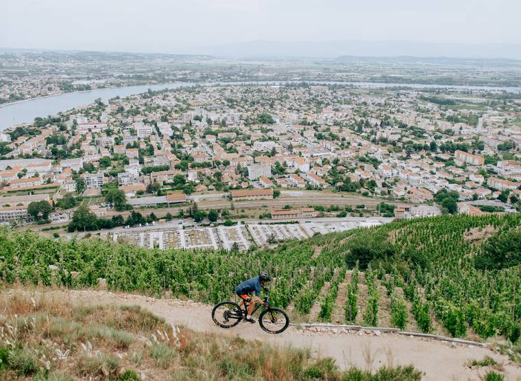
You'll set off on a challenging route south of Tournon to Plats (optional loop, can be shortened to around 20 km). Watch out, your calves are going to get hot. The return journey along the scenic route will be your reward.
To begin with, you follow the banks of the Rhône and then join those of the Doux. After a moment on the flat to warm up, you attack a long, physical climb that takes you to the heights of Tournon sur Rhône. This is followed by a fast, technical descent to a beautiful plateau.
At kilometer 10, you have the option of returning to Tournon without completing the additional loop.
On the original route, you continue on a loop through fields to the village of Plats, alternating between wide paths and pleasant single tracks, up and down in the forest.
Take the opportunity to admire the views over the Rhone valley from the various belvederes!
Once you've reached the village of Plats, you can stop for a break in the village shops.
The final descent to Tournon sur Rhône is quite challenging, with some tricky sections requiring a good command of mountain bike riding techniques.
Return to the quay via Tournon sur Rhône
Prices
Free of charge.
Opening
All year round.
Characteristics
Languages spoken
- English
- French
Services
- Parking nearby
- Bike repair
- Bike inflation


